


Warmer weather that arrived to finish off the work week will stick around into the start of the weekend. Not as cold for Saturday morning as temperatures bottom out in the mid 40s to mid-50s then expect highs Saturday in the low to mid.
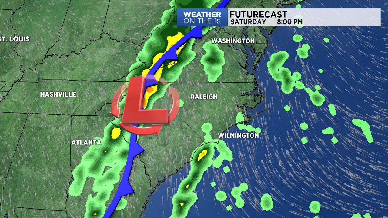
A cold front will sweep across the state this weekend creating some unsettled weather. Look for increasing clouds Saturday ahead of the approaching front with a chance for a few spotty showers.
Central and eastern North Carolina will see the best chance for rain from late Saturday night through Sunday morning. A few thunderstorms may rumble across the region during that time.
An area of low pressure will be moving up the front Sunday, but it should stay offshore from North Carolina. That may actually act to limit the rainfall in parts of the state. The Triangle, Sandhills, and southeastern North Carolina should see less than half an inch of rain early Sunday morning. The Outer Banks could see up to two inches Sunday. This low pressure system will really wind up and could become a major storm as it heads up the eastern seaboard.
In the North Carolina Mountains, cold air moving in behind the front may be enough to produce a few snow showers on Sunday, but little, if any, accumulation is expected.
Stay tuned to Weather on the 1s on Spectrum News for forecast updates through the weekend.