


Monday and Tuesday both featured cold starts with mild afternoons as sunshine warmed temperatures up nicely throughout the day. Wednesday will feature a similar scenario but will likely be the warmest day the Piedmont and mountains has seen since the 6th of November.
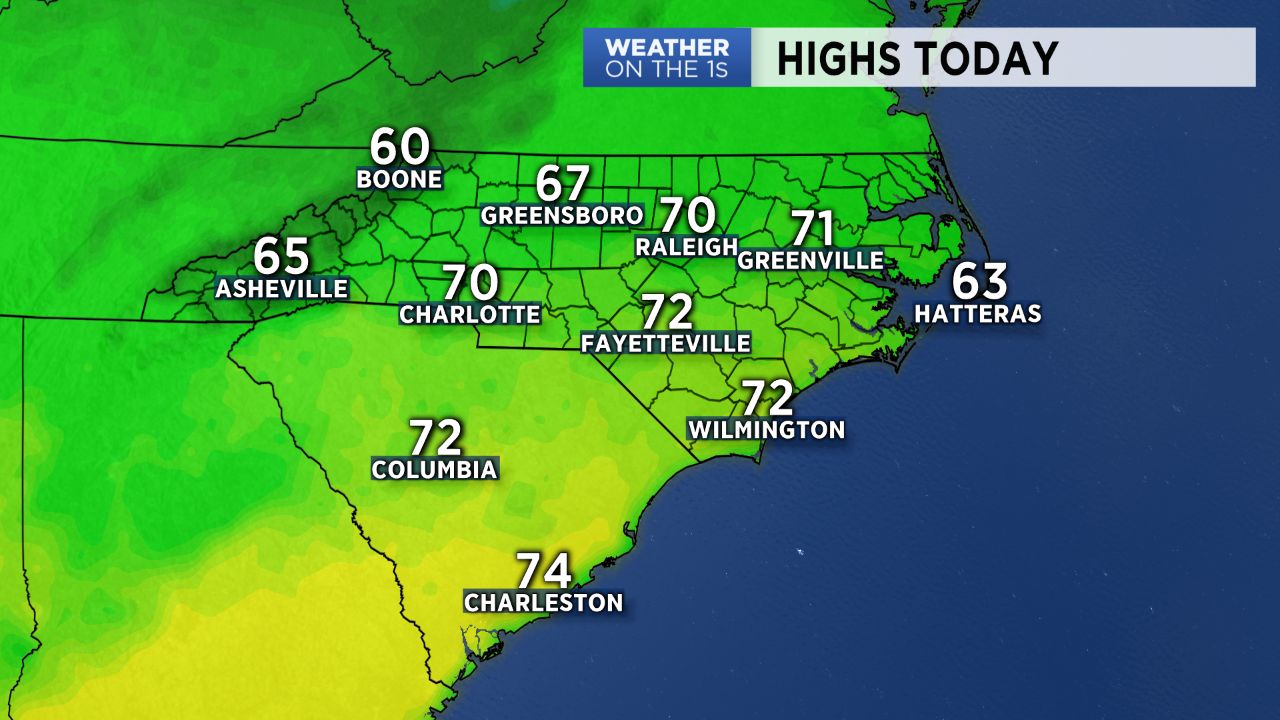
High pressure remains anchored over the region Wednesday, allowing for another day of sunshine and dry weather. With winds back out of the northwest Wednesday afternoon, temperatures will warm into the upper 60s and low 70s across the Piedmont -- highs that are more typical for mid-October than late November!
Thursday will bring another dry day until changes arrive Thursday evening. A cold front pushing in from the west will first bring showers to the High Country by Thursday evening before trickling into the Piedmont Thursday night into early Friday morning. Rainfall amounts will be quite light, with most areas across the Piedmont only expected to pick up a couple tenths of an inch tops, with higher amounts possible in the western mountains.
While most should stay during most of the day Friday, a "wedge" building in for Saturday could bring an additional chance for light showers to start off the weekend along with more cloud cover and a cool down in temperatures, with highs only expected to reach into the 50s Saturday afternoon. This will be short-lived, however, with sunshine making a comeback Sunday into early next week.
A much more drastic pattern change is on the horizon for late next week, so stay tuned!