


A cold rain is still expected for Carolinas Friday and Friday night. However, some locations may see that chilly rain mix with or change to light snow before ending late Friday night or early Saturday. There is no need to run to the store for bread and milk though. Snow accumulations, where they occur, should be pretty light with ground temperatures so warm and air temperatures hovering above freezing.
Rain will spread inland from the coast Thursday night into Friday morning across central North Carolina. Initially, the rain may be mixed with sleet pellets and a few snowflakes in the Piedmont. However, that should quickly change to a cold rain through the day Friday.
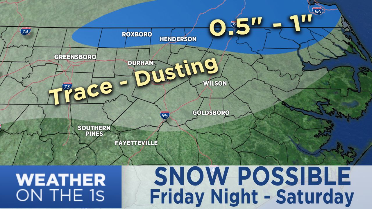
Locations around Greensboro and the Triad to the west toward the foothills should see anywhere from a dusting to one inch of accumulation Friday evening. A few isolated spots near the foothills could end up with slightly higher amounts.
Near and south of I-85 from Charlotte to Durham and Raleigh, Friday's chilly rain may transition to the snow/rain mix or light snow late Friday night into the early morning hours Saturday. However, accumulations are not likely. There may just be a few patches of a light dusting on the grass.
South and east of Raleigh, a few flakes may fly into the early morning hours Saturday, but most locations in eastern North Carolina will only see rain.
Another one to two inches of rain is likely in eastern North Carolina from Thursday through Saturday morning. The rest of the state including the Piedmont should see around half an inch to an inch of rain through Friday night.
All of the precipitation will end from west to east across the state from Friday night through Saturday midday.
Dry and cold weather is then expected for much of the weekend