


Parts of central and most of eastern North Carolina has a good possibility of snow on Wednesday.
All meteorological eyes are focused on an area of low pressure that is forecast to develop well off the east coast of Florida tonight. The low will then move northeast as it intensifies spreading moisture across the region.
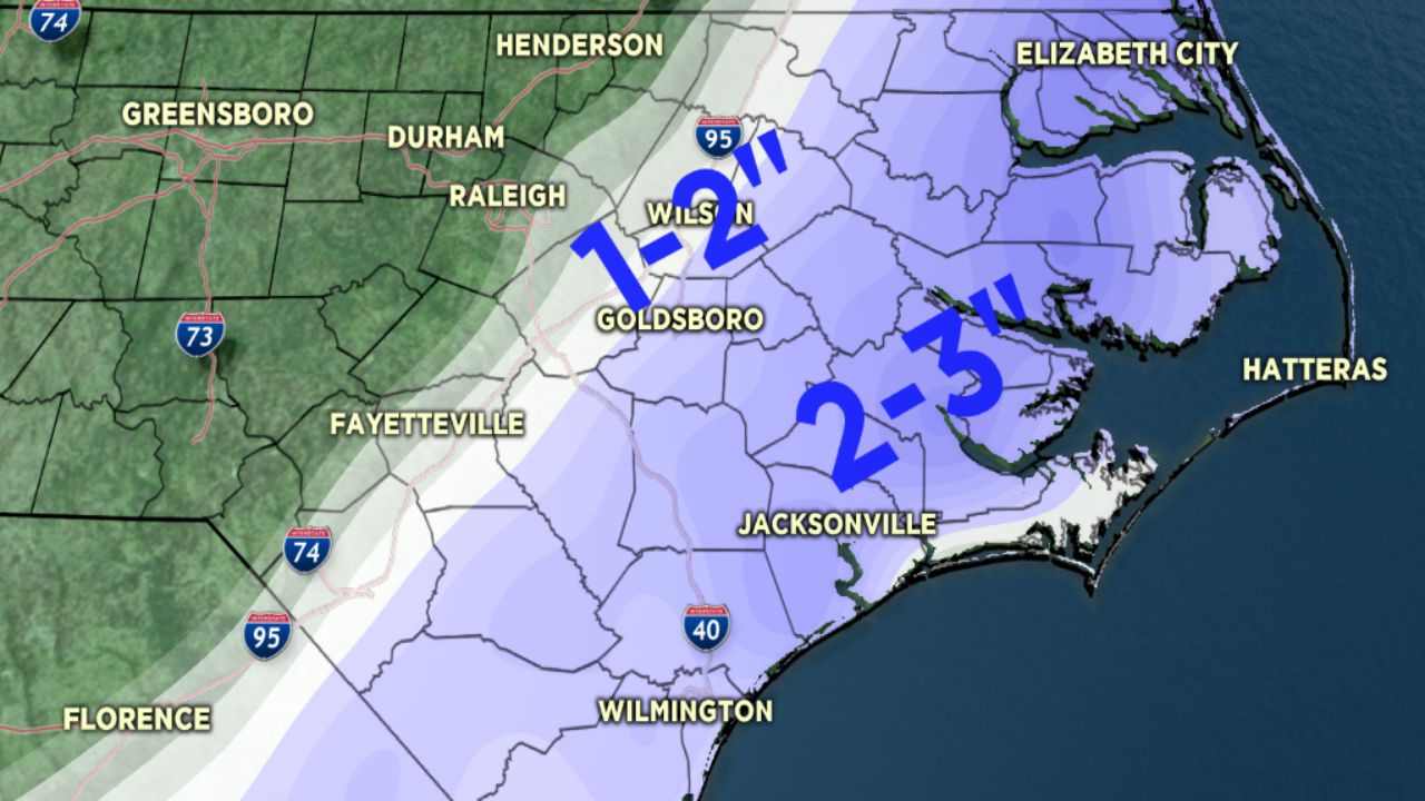
As of now it looks as if the area between the U.S. 1 and Interstate 95 corridor will see some light snow late Wednesday into Wednesday night with higher amounts just east of the I-95 corridor.
Parts of the Coastal Plain could see from two to three inches of snow by late Wednesday night.
For some near the coast a wintry mix is possible with some areas seeing the onset as rain, with a change to snow and possibly some freezing rain.
The system should pull away quickly enough to end the precipitation Wednesday night into Thursday morning.
The precise track and intensity of the low will greatly impact the type and amount of precipitation that falls across central and eastern North Carolina.
Another push of cold air will then settle in as we head into the weekend.