


A strong cold front moving in Tuesday night will bring snow showers across parts of North Carolina late Tuesday into Wednesday, which could make for a tricky commute Wednesday morning.
Tuesday will feature one more dry day with clouds increasing from the west by Tuesday afternoon. Light snow will be possible in the mountains as early as late Tuesday afternoon into Tuesday evening as a cold front begins its march across the Tennessee border.
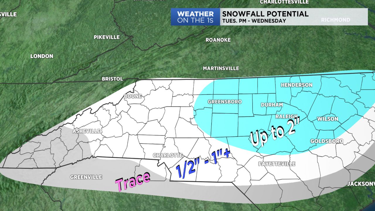
The Piedmont likely won't see snow until about midnight, where it could be mixed with rain to start off. As temperatures cool, precipitation will become all snow heading into very early Wednesday morning, which, with ground surfaces as cool as they are, should "stick" to the ground.
Accumulations will heavily depend on the amount of moisture this system will pack with it, but generally speaking, the Piedmont should expect between a half to even an inch-and-a-half of snow with heavier amounts farther north and east. With this anticipated snowfall, roads could become especially slick by Wednesday morning.
Snow will quickly exit by early Wednesday afternoon with cold, dry air to follow. Skies will clear by late Wednesday with a very cold start expected for Thursday morning.
Get the latest news, sports and weather delivered straight to your inbox. Click here to sign up for email and text alerts.