


After an all-day rain event Sunday, conditions will slowly dry out today from west to east before snow makes a comeback in the High Country Monday night into Tuesday morning.
Monday will begin with a cloudy start as rain continues to push off to the eastern half of the state. While a few lingering showers will be possible through the day Monday, most across the Piedmont should remain dry with some sunshine likely by this afternoon, particularly for areas to the west of I-77.
While lower elevations will see skies quickly clear out by this evening, the mountains will be dealing with another round of precipitation -- this time in the form of snow.
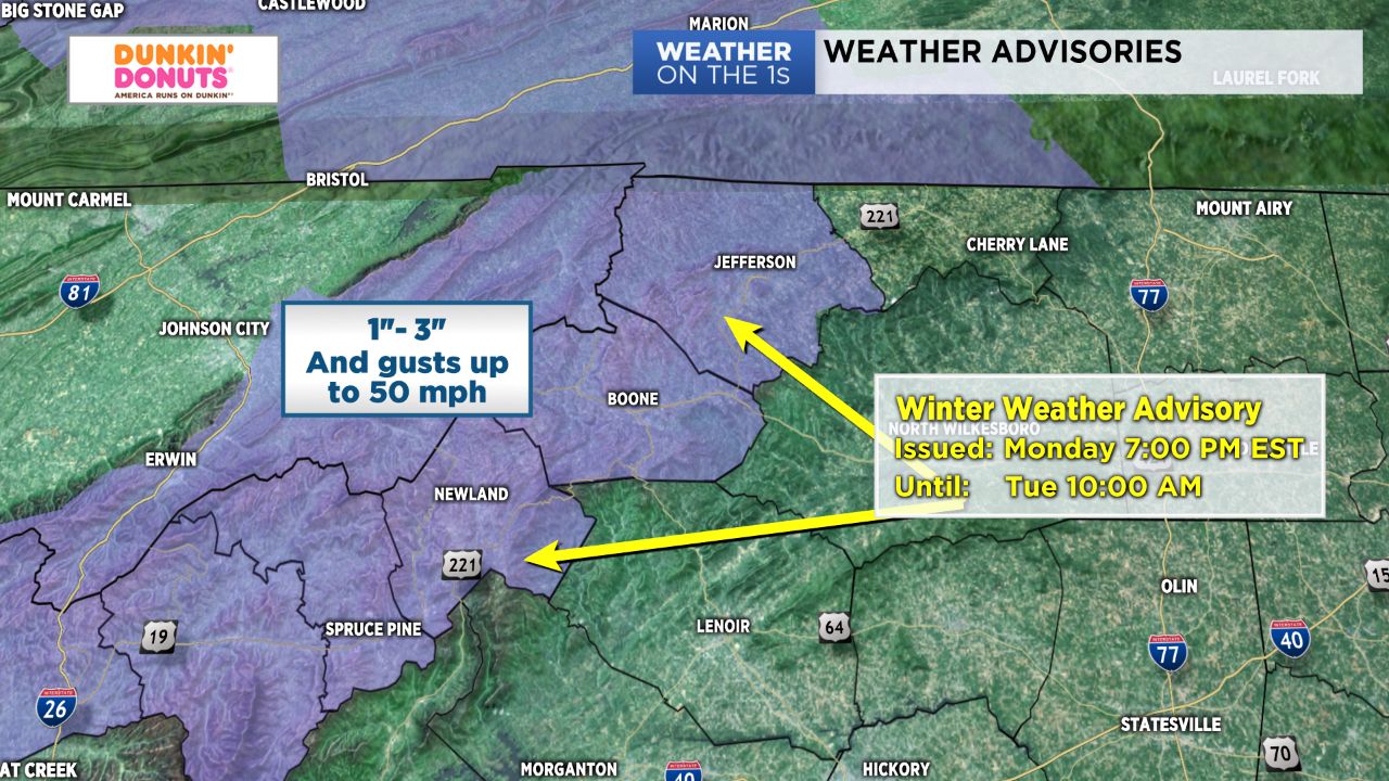
An upper level disturbance coupled with moist northwesterly flow will allow for overnight snow showers across the mountains. Winter Weather Advisories will be in effect beginning this evening for Ashe, Watauga, and Avery counties and last through tomorrow morning for snow accumulations between 1"-3".
Winds will also become gusty overnight, with local gusts up to 50 mph possible in the mountains. With cold air moving in, wind chills will drop to near zero by Tuesday morning in the High Country, making for a blustery morning across mountain locations.
By late Tuesday morning, snow showers should come to an end and leave the entire region with a day of sunshine and cooler conditions. Dry, sunny weather will prevail through Wednesday before chances of rain make a comeback late Thursday into Friday.
Get the latest news, sports and weather delivered straight to your inbox. Click here to sign up for email and text alerts.